
Category:Mundaring, Western Australia
Afrikaans: Mundaring (uitgespreek as man-dê-rieng) is sowat 34 km ten ooste van Perth langs die Great Eastern Highway geleë binne die Shire of Mundaring plaaslike regeringsgebied. (→Mundaring)
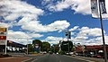
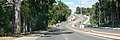
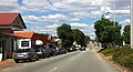
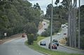
English: Mundaring is a suburb located 34 km east of Perth on the Great Eastern Highway. The suburb is located within the Shire of Mundaring. (→Mundaring, Western Australia)
suburb of Perth, Western Australia  | |||||
| Upload media | |||||
| Instance of | |||||
|---|---|---|---|---|---|
| Location |
| ||||
| Population |
| ||||
| Area |
| ||||
| Elevation above sea level |
| ||||
 | |||||
Subcategories
This category has the following 10 subcategories, out of 10 total.
B
- Beelu National Park (18 F)
M
- Mundaring Cemetery (1 F)
- Mundaring Hotel (15 F)
- Mundaring Sculpture Park (5 F)
- Mundaring War Memorial (1 F)
- Mundaring Weir Hall (1 F)
- Mundaring Weir road (33 F)
Media in category "Mundaring, Western Australia"
The following 39 files are in this category, out of 39 total.
-
 Albert Facey memorial library, Mundaring.JPG 2,377 × 1,437; 1.6 MB
-
 Former Mundaring Post Office.JPG 1,024 × 647; 217 KB
-
 Former Station Masters House Mundaring.jpg 2,897 × 881; 1,000 KB
-
 Great Eastern Highway central Mundaring .jpg 2,569 × 1,484; 1.57 MB
-
 Great Eastern highway hill before Mundaring.jpg 1,733 × 579; 293 KB
-
 Great eastern highway in Mundaring.JPG 2,079 × 959; 717 KB
-
 Great Eastern Highway in Mundaring.jpg 1,280 × 531; 287 KB
-
 Great Eastern Highway just out of Mundaring.jpg 1,183 × 508; 198 KB
-
 GreatEasternHighway Mundaring 2012.jpg 1,611 × 871; 619 KB
-
 GreatEasternHighwayMundaring 03 .jpg 1,828 × 701; 621 KB
-
 GtreatEasternH Mundaring 09.JPG 2,532 × 1,145; 1.67 MB
-
 Hodgson Street Sign, Mundaring.jpg 912 × 940; 304 KB
-
 Journey 2 110520 gnangarra-100.jpg 7,360 × 4,912; 20.85 MB
-
 Little athletics at Mundaring.JPG 2,138 × 614; 681 KB
-
 Loose Box fence and trees.JPG 1,024 × 678; 259 KB
-
 Msa + train, Mundaring, ca. 1940.jpg 615 × 559; 168 KB
-
 Mundaring 'The Hub'.JPG 2,129 × 1,141; 1.12 MB
-
 Mundaring anglican church.jpg 3,872 × 2,592; 1.59 MB
-
 Mundaring art centre entrance.jpg 1,280 × 848; 324 KB
-
 Mundaring building.JPG 2,592 × 1,936; 2.32 MB
-
 Mundaring council admin building.JPG 2,445 × 919; 937 KB
-
 Mundaring council building and solar panels.jpg 4,879 × 1,700; 1.75 MB
-
 Mundaring council building October 2019.jpg 4,907 × 1,672; 1.74 MB
-
 Mundaring CWA.JPG 1,489 × 835; 813 KB
-
 Mundaring GEH October 2013 .jpg 1,024 × 678; 221 KB
-
 Mundaring memorial.JPG 2,592 × 1,936; 2.07 MB
-
 Mundaring Railway Station Masters House.jpg 3,087 × 702; 881 KB
-
 Mundaring Recreation ground.JPG 2,425 × 1,002; 1.3 MB
-
 Mundaring scout hall.JPG 2,592 × 1,936; 2.72 MB
-
 Mundaring Sporting Club.JPG 1,937 × 726; 861 KB
-
 Mundaring Town Hall, Jacoby Street, Mundaring.jpg 3,374 × 1,898; 1.24 MB
-
 Mundaring war memorial at Great Eastern Highway.jpg 2,916 × 1,066; 875 KB
-
 Mundaring War memorial in 2005.jpg 1,024 × 768; 334 KB
-
 Mundaring Weir road 0813.jpg 4,272 × 2,848; 6.59 MB
-
 Mundaring with smoke from controlled burn.jpg 2,947 × 1,393; 786 KB
-
 MundaringCatholicChurch.JPG 2,301 × 1,009; 1.35 MB
-
 Side of Station Master House.jpg 1,134 × 957; 385 KB
-
 The Loose Box, Mundaring, 2013.JPG 4,928 × 3,264; 8.25 MB
-
 View of Jacoby & Nichol Street, Mundaring.jpg 3,264 × 1,836; 3.11 MB


